Here are posters done by Angelo researchers and teams over the last 5 years…
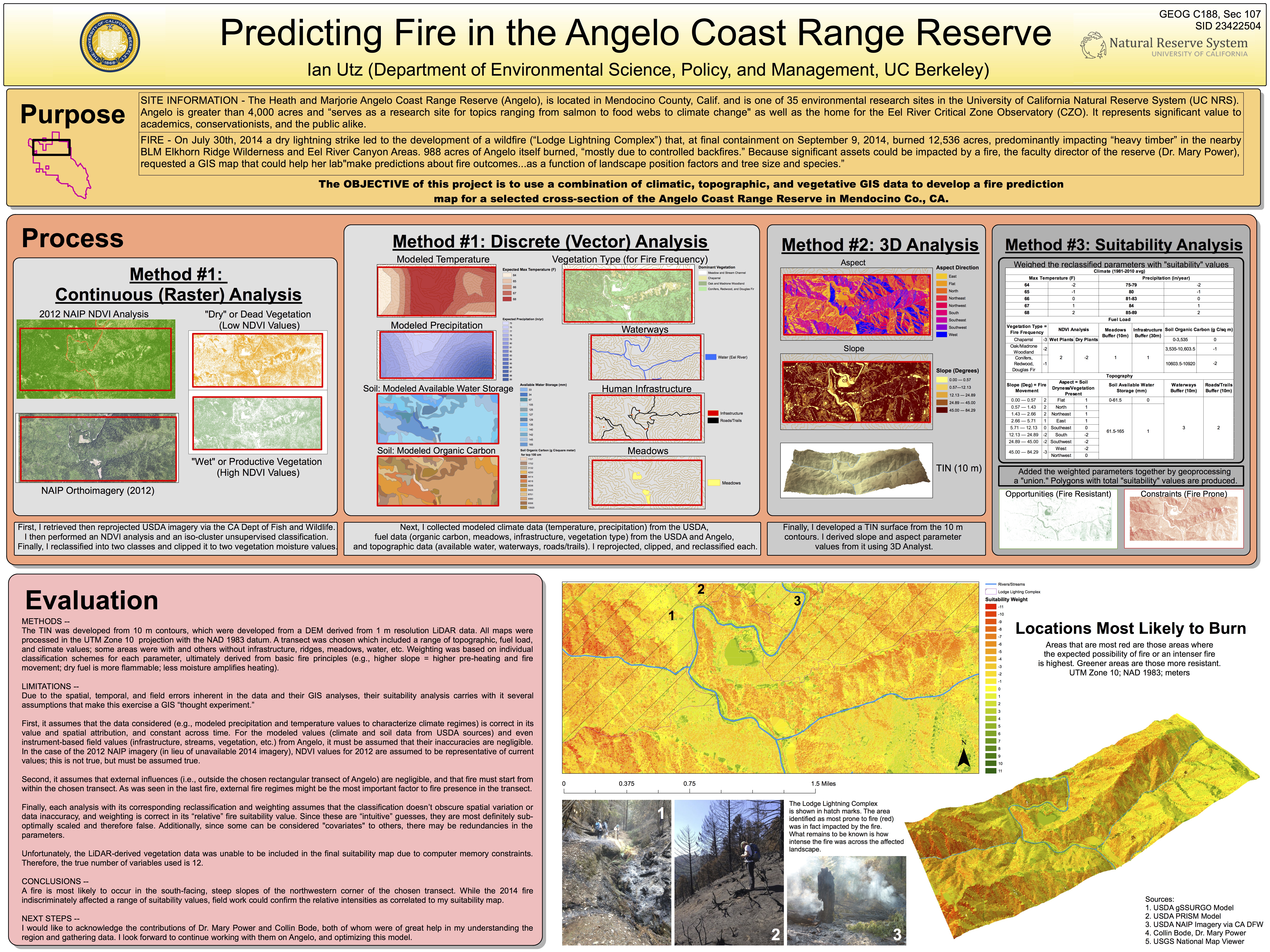
Ian Utz, an undergraduate at UC Berkeley, analyzed fire vulnerability as a function of landscape position and vegetation for his class GIS project–he plans to test the hypotheses he puts forth in this poster with field work over the sites that burned, or didn’t, last August 2014. He will also modify his predictions using some higher resolution LiDAR derived data on topography and vegetation.