The National Center for Earth-surface Dynamics (NCED) hosts many of the GIS coverages:
- Shapefiles: Research and Watershed GIS Boundaries, Eel River to Rivendell — (2004-2015)
- Digital Elevation Models: Bare-earth, Canopy, and Vegetation Height
- Derived DEMs: Slope, Aspect, Flow Accumulation, Contours, Area/cell size (A/B).
- USGS 7.5′ Quads within the Angelo Area
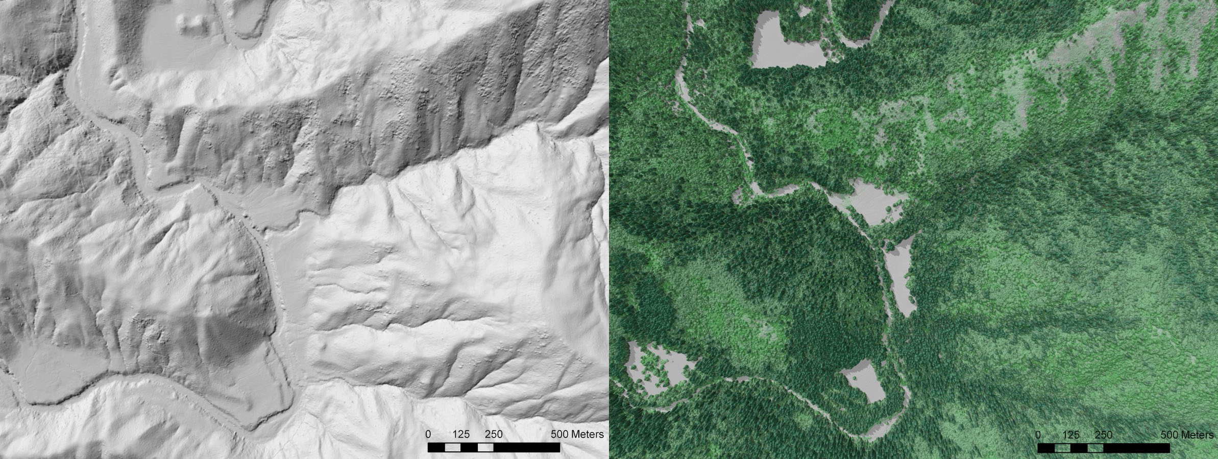
LiDAR has been flown multiple times over the Reserve area by the National Center for Airborne Laser Mapping (NCALM) and is housed at Open Topography.org.
- 2004 South Fork Eel River, CA Watershed Morphology
- 2009 South Fork Eel River, CA: Understanding Terrace Formation and Abandonment
- 2014 Eel River Critical Zone Observatory Lidar Survey